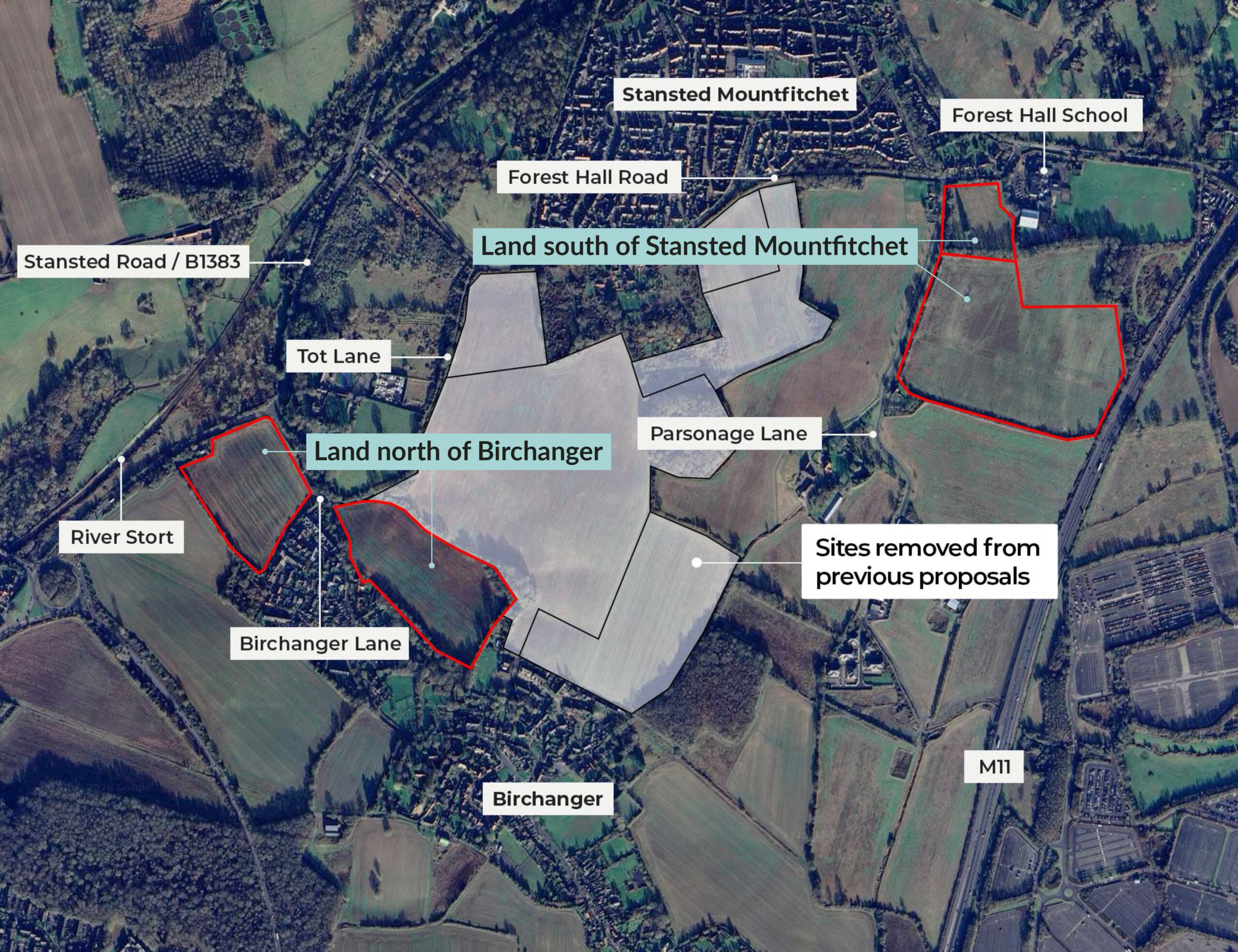
The site
Ideally situated for access to local amenities
City & Country have submitted two planning applications. One for the land south of Stansted Mountfitchet and one for the land north of Birchanger.
The Stansted Mountfitchet site is located to the south of the existing village and is adjacent to Forest Hall School and Mountfitchet Romeera Leisure Centre. Immediately surrounding the site is Forest Hall Road, Parsonage Lane and Church Road, with Stansted Airport and the M11 to the east of the site.
The Birchanger site is adjacent to Stansted Road (B1383), Birchanger Lane, Tot Lane, and borders the existing settlement.
First application
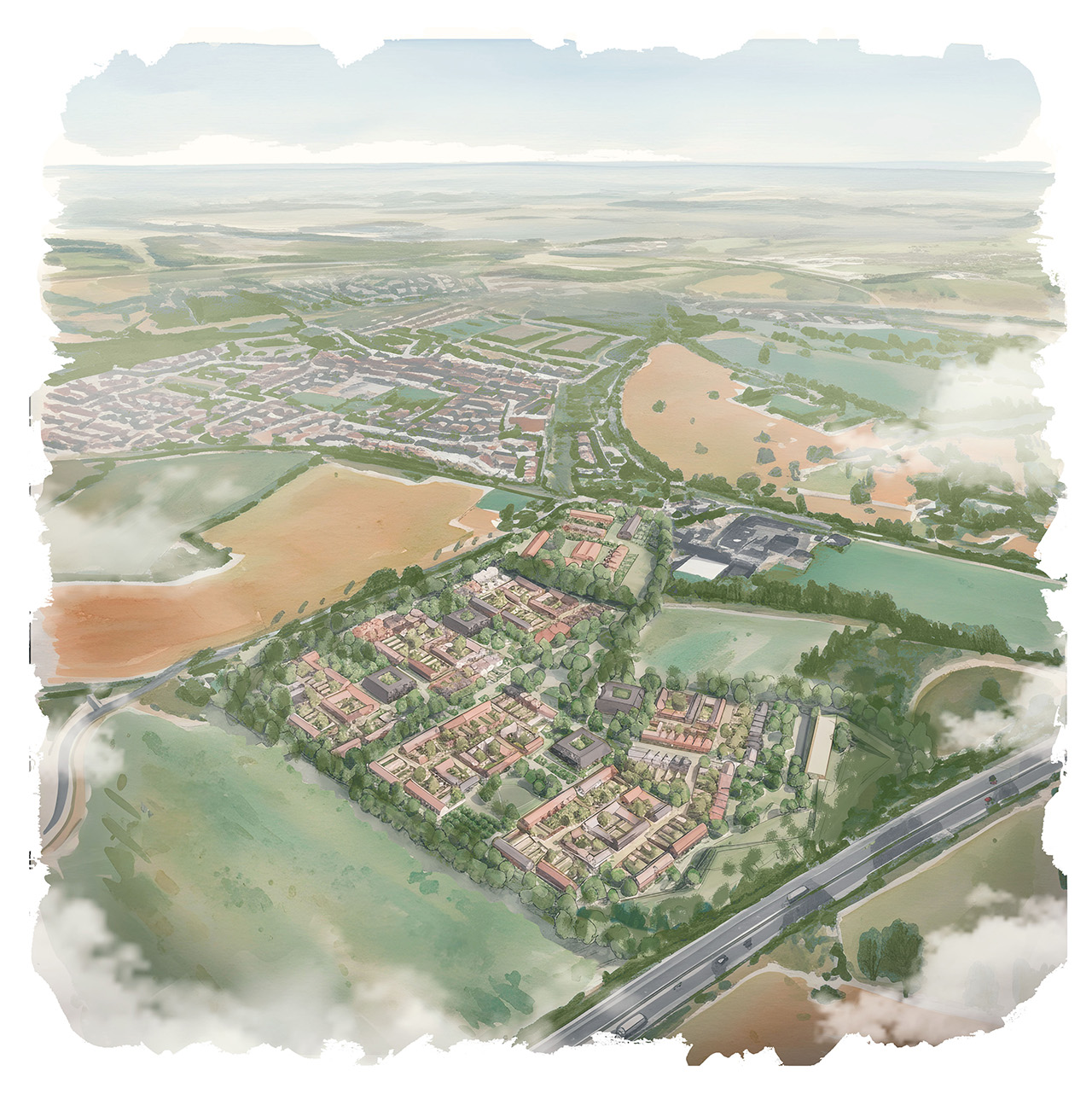
Land south of Stansted Mountfitchet
The proposed Stansted site is strategically placed in a sustainable location with strong transport links, local amenities including schools, healthcare provision and leisure facilities, and good connections to the centre of Stansted Mountfitchet and nearby town of Bishop’s Stortford. With convenient access to local bus stops and to Stansted Mountfitchet Railway Station, the locations offers fast links to both London and Cambridge. The centre of Stansted Mountfitchet, with its railway station, shops and health centre is 15 minutes walk and 5 minutes cycle from the site. Stansted Airport is 15 minutes away by bus, or 25 minutes away by bike. There is a secondary school and leisure centre adjacent to the site.
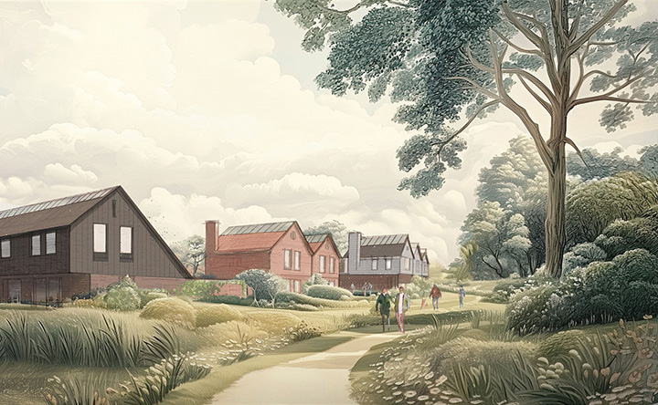
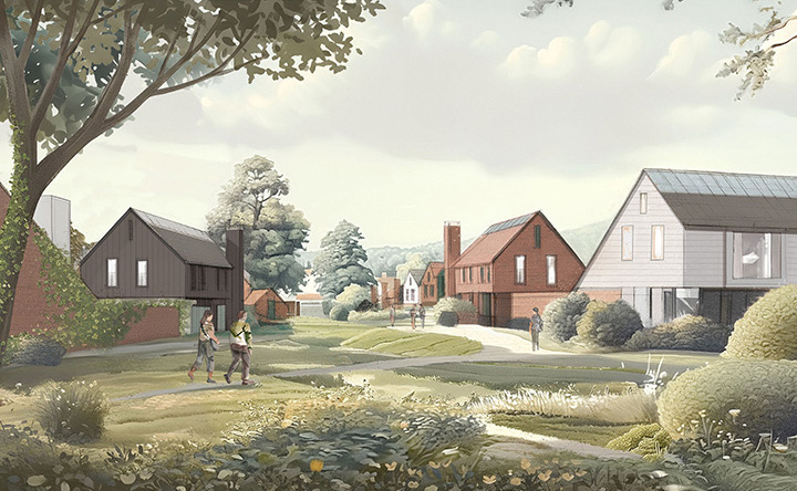
150 private homes, 150 affordable homes and a care home are proposed, as well as small cluster of local facilities including a shop, café, nursery, shared workspace, and gym – ensuring that daily needs can be met without reliance on car travel. In addition, land is allocated for the potential expansion of Forest Hall Secondary School and for a village hall for Stansted Mountfitchet. The development will also include additional play provision and new green spaces that the existing and new residents of the village will be able to enjoy. All the homes will be built to Uttlesford’s emerging policy to have net zero carbon operational energy usage.
Second application
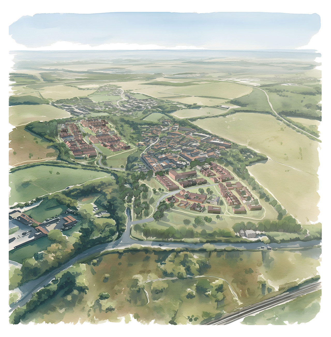
Land north of Birchanger
The proposed Birchanger site is located close to transport links and local amenities such as a pub, sports & social club and primary school. The sites’ sustainability will be ensured by the provision of improved pedestrian and cycle links to local bus stops, Stansted Mountfitchet to the north and Bishop’s Stortford to the south, as well as improvements to the existing highway network. Stansted Mountfitchet Railway Station is 15 minutes away by cycle or 10 minutes by ebike and offers fast links to both London and Cambridge. Cycling to Forest Hall School would only take 6 minutes using our proposed improved cycle links, and Stansted Airport is a 22 minute cycle ride away, or 24 minutes by bus. There are allotments and a playground adjacent to the site.
90 private homes and 90 affordable homes are proposed, as well as new green spaces that new and existing residents can enjoy. Land is set aside should the primary school need to expand. The homes here will also be net zero carbon operational energy usage.
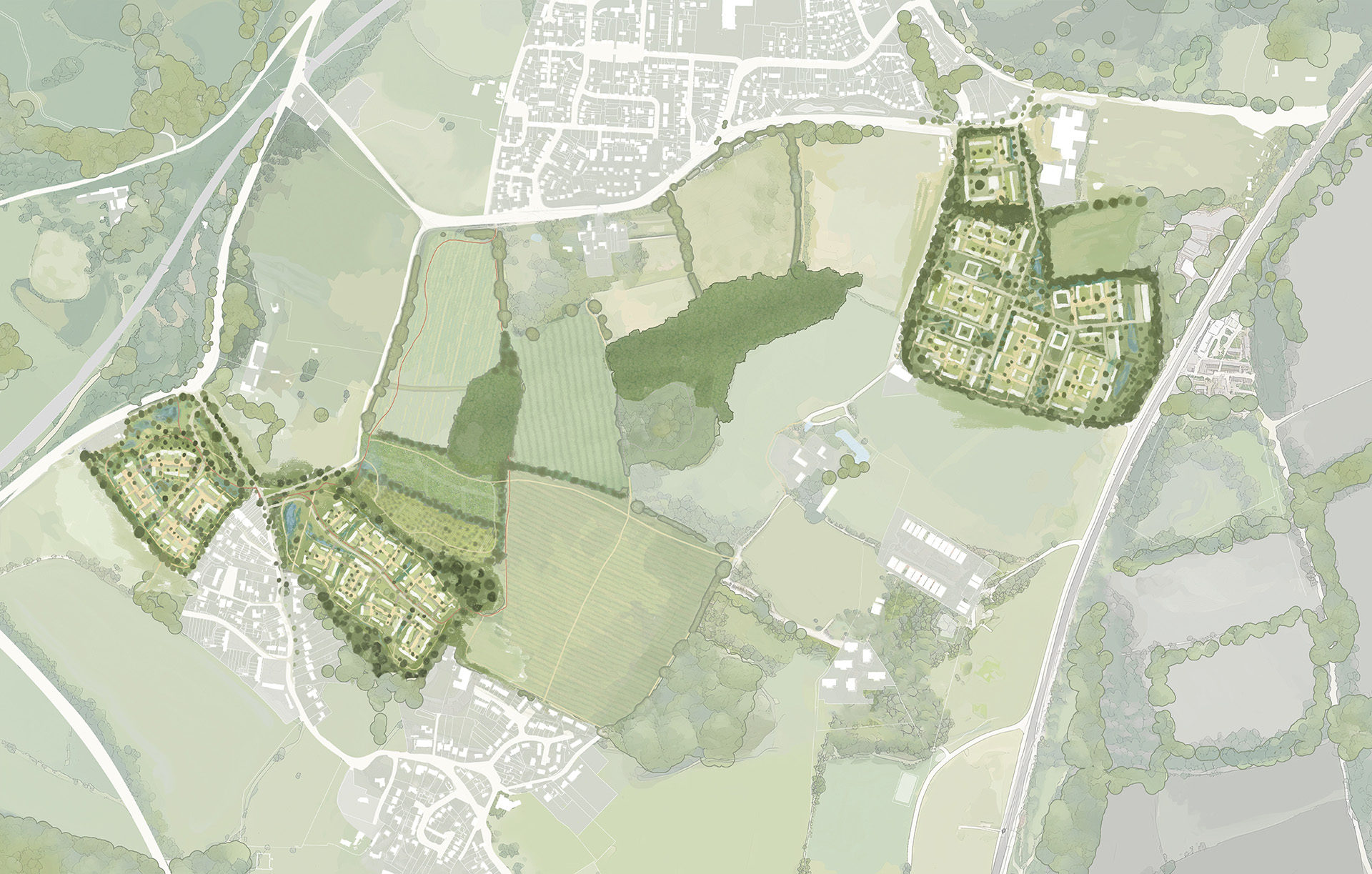
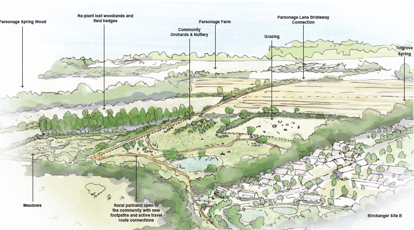
Green gap
Land between Birchanger and Stansted Mountfitchet
Further parcels of land between Birchanger and Stansted Mountfitchet are also in the ownership of City & Country. These parcels of land will be enhanced with the addition of new woodland and hedgerows, as well as new pedestrian and cycle routes to increase connectivity and encourage sustainable car-free travel. City & Country will also be applying to Natural England to create a large habitat bank between Stansted & Birchanger to provide significant biodiversity enhancement and conservation through the restoration of pastureland, lost woodland, lost hedgerows and other natural habitats. This will be legally protected and will prevent Stansted Mountfitchet & Birchanger coalescing. The proposals will significantly enhance the biodiversity of the land compared to its current arable use, improving habitats for wildlife.
Key benefits of the scheme
Land south of Stansted Mountfitchet
- 150 affordable and 150 private homes as well as care home provision, shared workspace, shop, café, nursery and private gym.
- 4.77 acres of land allocated for Forest Hall School expansion and new village hall
- 14.73 acres of new public open space, that the new and existing residents of Stansted can enjoy
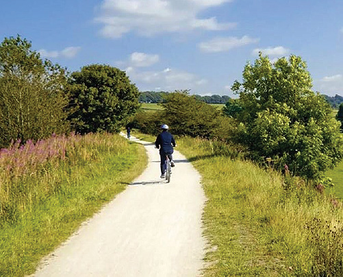
- 4 km of footpaths & cycleways
- New pedestrian crossing adjacent to the site
- New traffic lights and pedestrian crossing at the Forest Hall Road / Stansted Road junction
- Landscaped earth bund and 50m gap from M11 to new homes to provide acoustic separation
Key benefits of the scheme
Land north of Birchanger
- 90 affordable and 90 private homes
- 1.33 acres of land allocated for Birchanger Primary School expansion
- 15.77 acres of new public open space that the new and existing residents of Birchanger can enjoy
- 4 km of footpaths & cycleways
- Traffic lights and pedestrian crossing at the Birchanger Road / Stansted Road junction
- Traffic calming on Birchanger Lane including priority for cars leaving Birchanger to reduce rat running
- Safe footpath link from Stansted Road bus stop to centre of village
Key benefits of the scheme
Both sites
- At least a 20% Biodiversity Net Gain
- Net zero operational energy use from the homes
- 100% of homes provided with electric car chargers
- Contribution to upgrading of A120 / Stansted Road roundabout
- School places are available at both Forest Hall & Birchanger Primary Schools
- Contribution to fund the closure of Tot Lane to vehicular traffic, enabling it to become a pedestrian & cycle route and protecting its historic character
- Contribution to cycle route improvements towards Bishops Stortford

Key benefits of the scheme
Green gap
- Approximately 100 acres of enhanced landscape with replanted woodland and hedgerows, with existing ancient woodland, trees and hedgerows protected.
- Legally binding habitat bank to enhance biodiversity on site and prevent the villages joining together
- 9km of cycle ways and footpaths to enhance the linkages between Stansted Mountfitchet and Birchanger.
Travel plan
Transport and access
The sites are both well connected to public transport, much more so than many other areas within the Uttlesford. The proposals also include various enhancements to the highways network to enhance safety and help deal with the additional traffic the developments will generate. These include:
- 16.85 km of pedestrian and cycle paths (“active travel routes”) proposed between Stansted & Birchanger to make it easier to connect between the villages
- Pedestrian crossing adjacent to Forrest Hall School
- Traffic lights where both Forest Hall Road and Birchanger Lane join Stansted Road as well as pedestrian crossings to the existing bus stops to make the junctions safer.
- Traffic calming on Birchanger Lane including priority right of way for cars leaving Birchanger to help limit rat running
- New footpaths from the Birchanger Stansted Road bus stop to City & Country sites and into the centre of the village as the current footpath to the main road is very narrow
- We are proposing a contribution to support the closure of Tot Lane, as this has very little traffic and would provide an attractive route for pedestrians and cyclists. If the closing of Tot Lane is not agreed, then we will provide a new cycle and footway parallel to Tot Lane within the green gap.
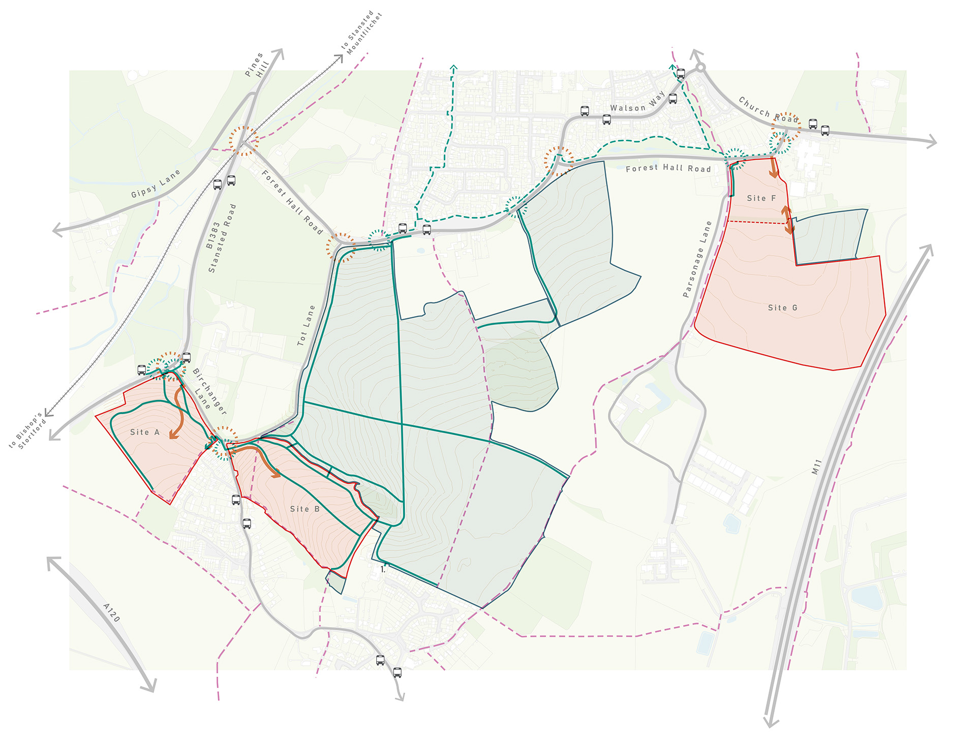
 Proposed development site
 Other land in client ownership
 1m contours
 PROW – Bridleway
 PROW – Footpath
 Existing shared-use path (Equestrian, cycle and pedestrians)
 Existing footway of interest
 Existing bus stops
 Proposed crossing or improvement to existing
 Key junctions of interest
 Potential site accesses
 Proposed active travel routes indicatively shown
 Potential active travel link to primary school
Affordable housing
Addressing the housing waiting list
The number of households on the housing waiting list in Uttlesford, as at 31 March 2025, is 1,461. This has increased by 34% over the last six years according to the Local Government Inform website, based upon MHCLG figures, as shown here:
| Year | Total housholds on housing waiting list |
|---|---|
| 2018/19 | 1090 |
| 2019/20 | 1108 |
| 2020/21 | 1337 |
| 2021/22 | 1272 |
| 2022/23 | 1328 |
| 2023/24 | 1461 |
Source: Ministry of Housing, Communities and Local Government.
The number of completed affordable homes delivered from 2018/19 to 2023/24 for Uttlesford is shown here:
| Year | Additional completed affordable homes |
|---|---|
| 2018/19 | 376 |
| 2019/20 | 348 |
| 2020/21 | 9 |
| 2021/22 | 106 |
| 2022/23 | 112 |
| 2023/24 | 28 |
This means that the c.240 affordable homes being provided on these sites alone will provide more affordable housing than the whole of Uttlesford District has provided annually in the last four years.
Although the planning application is in outline, the proposed mix of affordable new homes is broadly in accordance with the Council’s indicative policy mix for Affordable Housing as set out in the emerging Local Plan for the first 35% (c.168 dwellings). The tenure split of that 35% will be 70% affordable/social rent and 30% home ownership. The additional 15% above the policy requirement (c.72 dwellings) will be low cost market housing, as defined in the definition of Affordable Housing as set out in Annex 2 of the NPPF. The overall affordable housing mix proposed for each site is as follows:
| Housing type | Emerging policy | Proposal |
|---|---|---|
| 1 bed apartments | 20-25% | 26% |
| 2 bed apartments | 30-45% | 42% |
| 2 bed houses | 30-45% | 42% |
| 3 bed houses | 35% | 24% |
| 4 bed houses | 10-35% | 8% |
| Total | 100% |
| Housing type | Emerging policy | Proposal |
|---|---|---|
| 1 bed apartments | 20-25% | 22% |
| 2 bed apartments | 30-45% | 30% |
| 2 bed houses | 30-45% | 30% |
| 3 bed houses | 35% | 34% |
| 4 bed houses | 10-35% | 14% |
| Total | 100% |
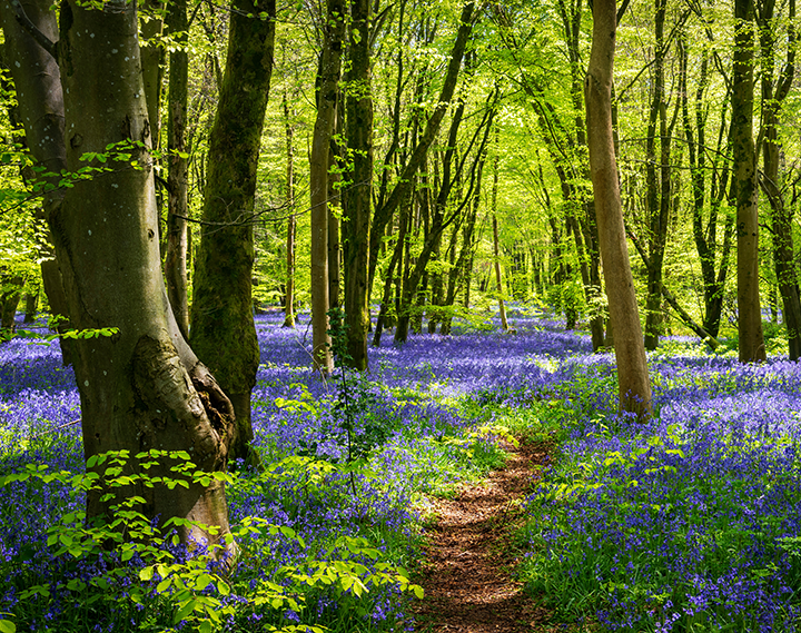
Ecology
Enhancing access to the countryside and protecting existing woodland
The sites contain areas of ancient woodlands and what remains of historic hedgerows as well as some very fine ancient trees. All of these elements will be retained and protected. Over the generations hedgerows and a woodland called Tot Grove have been removed and replaced with arable farmland, which is of low ecological value. We will be replanting these lost landscape elements, as well as providing new pastureland, orchards and a habitat bank. The habitat bank is an area of land that will be registered with Natural England and will be planted to enhance the biodiversity of the site and will be legally protected from development for a minimum of 30 years. The sites adjacent to Stansted Mountfitchet and Birchanger will also have the existing hedges and trees protected, and provide a significant biodiversity net gain of more than 20%.
Overall, the proposals will massively enhance the ecology on the sites and encourage native species to thrive and return to the landscape. The proposals will also enhance access to the countryside and provide residents with a better understanding wildlife in the area.
Indicative proposed timeline
How will the project move forward?
November / December 2024
First round of engagement launched.
Early 2025
Reviewed community feedback and updated proposals where appropriate.
Spring 2025
Ongoing conversations with the council regarding the plans and updating them ahead of a second round of engagement.
September / October 2025
Second round of engagement takes place.
November 2025
Applications submitted. Statutory and public consultation underway until December 2025.